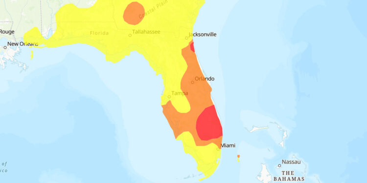
Many Sebastian locals are remaining indoors due to a light brownish haze in the region. This haze, originating from wildfires in eastern Canada, has traveled to Florida.
According to the National Oceanic and Atmosphere Administration (NOAA), these significant fires near Hudson Bay are ushered southward by a high-pressure system passing through the Tennessee River Valley.
Furthermore, a substantial storm in the open Atlantic is playing a role in driving the smoke down the U.S. East Coast.
Although the smoke is evident in the broader Sebastian region, it’s even denser in other parts of Florida.
For today’s air quality updates in east Florida, one can refer to the EPA’s AirNow forecast. For real-time air quality checks, input your ZIP code on the AirNow.gov portal.
On Tuesday, the air quality was rated as moderate. Those vulnerable to particle pollution might want to stay indoors until the situation improves. The haze will linger through Wednesday.
The National Weather Service has issued another flood advisory on Tuesday, but it’s set to expire in the afternoon. For this week, expect daytime highs around 85 degrees and nighttime lows near 72. Winds will peak at 10 to 15 mph on Tuesday, then lessen to 5 to 10 mph. The prevailing wind direction will be from the northeast, with a 30% chance of rain.


