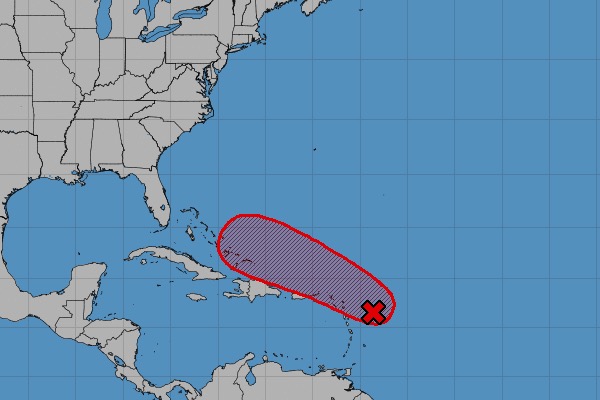
SEBASTIAN – The National Hurricane Center said that a tropical wave is heading towards Florida with an 80 percent chance of cyclone formation within the next five days. However, residents living in Sebastian and Vero Beach may not experience much.
The tropical wave is located about 200 miles east of the Leeward Islands and continues to produce a large area of disturbed weather over much of the western tropical Atlantic Ocean. Although environmental conditions are forecast to gradually become more conducive for a tropical depression to form during the next few days, interaction with land could inhibit tropical cyclone formation.
“The disturbance is forecast to move westward to west-northwestward for the next few days, passing near or north of the Leeward Islands, Puerto Rico, Hispaniola, and the southeastern Bahamas. Interests in these areas should closely monitor the progress of this system,” the National Hurricane Center said.
The current tropical wave is another reminder that the 2018 Hurricane Season isn’t over for Sebastian and Vero Beach. This weather disturbance isn’t expected to be a major hurricane.
We are keeping an eye on this storm as it makes its way through the northern Caribbean Sea and into Puerto Rico. Also, a cold front will be moving into the Northwestern Caribbean Sea Wednesday night and into Thursday.
However, a trough of low pressure moving toward the east coast is expected to steer the system away from Florida and our area. It’s still too early to predict where the wave will go.
Sebastian Daily will continue to monitor the Atlantic and bring you regular updates.


