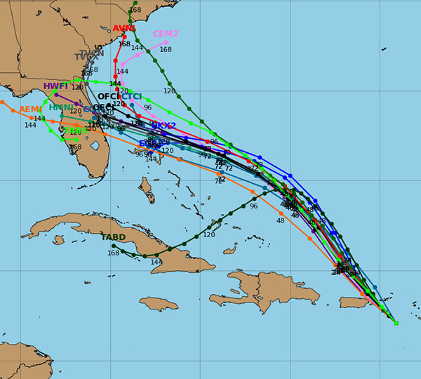
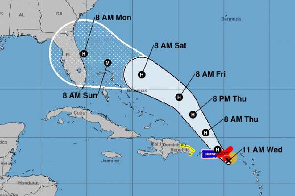
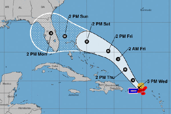
The latest advisory from the National Hurricane Center is showing some concerns for Sebastian, Florida.
This morning, the track put Dorian near north Florida before it makes landfall. The latest advisory shows the track moved south, putting Melbourne in the center of the cone of uncertainty.
Dorian was expected to move over western Puerto Rico, which would have slowed the storm down. Unfortunately, the system moved to the east, and that means warmer waters and intensity.
“All indications are that by this Labor Day weekend, a powerful hurricane will be near the Florida or southeastern coast of the United States,” the National Weather Service said in a statement.
As of right now, Dorian could make landfall near Sebastian, or it could continue on a northern pattern and make landfall near Georgia.
The question is: Where will Hurricane Dorian make landfall?
Dorian could change direction again, and forecasters expect it to because of it’s unexpected behavior. We have seen this storm go from being a “dissipated storm” last weekend, to a hurricane that now threatens the east coast of Florida.
Dorian could make landfall by Monday morning at 8:00 a.m. with maximum sustained winds of 115 mph.

For Sebastian, watch the weather reports on Thursday. There’s no need to panic right now as this storm can change direction. Gather your supplies now and be prepared in case Hurricane Dorian is at our doorstep.
We will continue to update you on Dorian throughout the weekend.


