It is that time of year, and we’ll reach the 2020 Atlantic peak season in about two weeks from now.
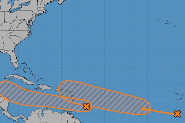
Forecasters are monitoring two tropical waves in the Atlantic, which will make their way through the Caribbean this week.
The first tropical disturbance is located a couple of hundred miles east of the Windward Islands and expected to produce disorganized shower and thunderstorm activity.
“This disturbance is expected to move westward at about 20 mph during the next few days, and that fast forward speed is likely to limit significant development while the system approaches the Windward and southern Leeward Islands today, and moves across the eastern and central Caribbean Sea on Tuesday and Wednesday,” the National Hurricane Center (NHC) said in a statement.
The system is expected to move more slowly westward across the western Caribbean Sea, where upper-level winds could become more conducive for the development of a tropical depression during the latter part of this week. The chance of formation during the next five days is 50 percent.
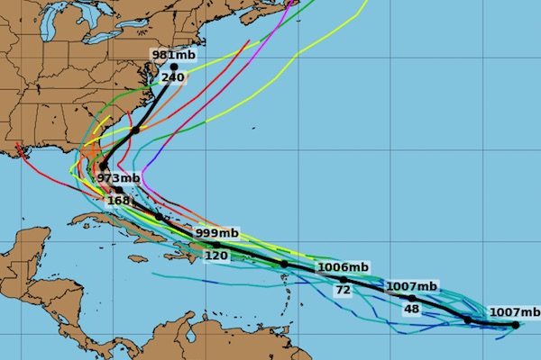
The second tropical wave is one Sebastian Daily is keeping an eye on since it could be a threat to Florida.
“The wave is forecast to move westward to west-northwestward at 15 to 20 mph during the next few days, and environmental conditions are expected to become more conducive for the development of a tropical depression during the middle-to-latter part of this week while the system moves across the central and western portions of the tropical Atlantic,” the NHC said.
There’s a 60 percent chance of formation during the next five days.
As of right now, neither tropical wave threatens Sebastian, Florida. It’s also important to remember that just because a wave may be heading our way doesn’t mean it will become a major hurricane. We won’t know the details for several days.
Sebastian Daily will provide further updates as the National Hurricane Center releases more information.


