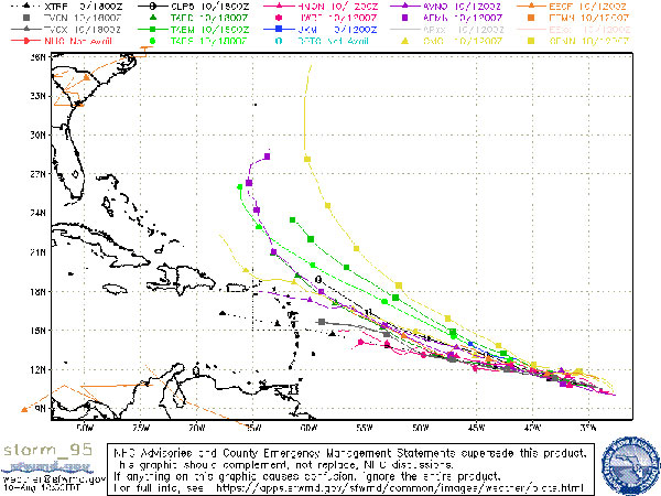
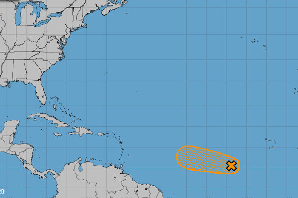
There’s a tropical disturbance moving towards the Caribbean, but forecasters say it will turn northward before moving out to sea.
Sebastian Daily is still keeping an eye on the storm as a precaution because of what we saw with Hurricane Dorian last year. Dorian was supposed to take a similar path but continued northwest instead.
As of today, the tropical disturbance poses no threat to Florida. Current spaghetti models show it moving out to sea.
“However, environmental conditions are expected to be somewhat conducive for development to occur, and a tropical depression could form during the next couple of days while the disturbance moves generally westward to west-northwestward at 10 to 15 mph across the tropical Atlantic. Conditions are forecast to become less conducive for development by the end of the week,” the National Hurricane Center said in a statement.
Forecasters say there’s a 60 percent chance of development within the next five days.

The Saharan dust begins to calm down around this time of year, bringing favorable conditions for a hurricane. The dust usually slows storms down, which is what we saw with Isaias when it moved past Florida on August 2, 2020.
Sebastian Daily will keep you informed should anything change. The 2020 Atlantic Hurricane Seas is from June 1 thru November 30.
It’s a good idea to be prepared all season! Please download the Official Disaster Preparedness Guide for Indian River County.


