Forecasters at the Climate Prediction Center, a branch of the National Weather Service, expect a nearly standard hurricane activity in the Atlantic for 2023, according to NOAA.
The 2023 Atlantic hurricane season, running from June 1st to November 30th, presents a 40% probability for an average season, 30% for a busier than average season, and another 30% for a quieter than average one.
NOAA predicts a total of 12 to 17 named storms (winds of 39 mph or more), of which 5 to 9 might become hurricanes (winds of 74 mph or more), including 1 to 4 major hurricanes (category 3, 4 or 5; winds of 111 mph or more). These ranges are issued with a 70% confidence level by NOAA.
The roster of storm names for 2023 includes 21 names, covering nearly every letter of the alphabet. It’s important to note that the task of naming tropical cyclones falls under the purview of the World Meteorological Organization (WMO), not the U.S. National Hurricane Center.
The list of names for the Atlantic tropical storms in 2023 reads as follows: Arlene, Bret, Cindy, Don, Emily, Franklin, Gert, Harold, Idalia, Jose, Katia, Lee, Margot, Nigel, Ophelia, Philippe, Rina, Sean, Tammy, Vince, and Whitney.
In case of an unusually active season that exhausts this main list of names, a backup list will be deployed.
Secretary of Commerce Gina M. Raimondo credited NOAA’s advancements in hurricane modeling to the investments made in science and technology this year. The improvements aim to increase forecast accuracy to better prepare communities for Atlantic hurricanes’ economic and ecological impacts.
The upcoming hurricane season might be less eventful than the previous ones due to a blend of opposing influences, some stoking and some suppressing storm development. Despite the presence of La Nina during the last three hurricane seasons, NOAA scientists expect a strong likelihood of El Nino formation this summer, which usually dampens Atlantic hurricane activity.
However, this may be counteracted by conditions favorable to storm development in the tropical Atlantic Basin, such as potential above-average West African monsoon and warmer-than-average sea temperatures in the tropical Atlantic Ocean and Caribbean Sea. Such factors are part of the longer-term variability in Atlantic conditions, known as the high-activity era for Atlantic hurricanes since 1995, which has led to busier Atlantic hurricane seasons.
NOAA Administrator Rick Spinrad, Ph.D., emphasizes the increasing importance of NOAA’s data and expertise to decision-making in the face of changing climate and hurricane scenarios. Therefore, NOAA plans to operationalize a new hurricane forecast model and extend the tropical cyclone outlook graphic from five to seven days for better preparation.
NOAA also plans to enhance its operational supercomputing system’s capacity by 20%, facilitating more complex forecast models. One significant upgrade this season will be the introduction of the Hurricane Analysis and Forecast System (HAFS) in late June. Based on retrospective analysis, this model demonstrates a 10-15% improvement in track forecasts over existing models.
Further improvements are planned for storm surge forecasting and additional tools for hurricane analysis. The Tropical Weather Outlook graphic, which shows cyclone formation potential, has been expanded from five to seven days, and the Excessive Rainfall Outlook has been extended to five days.
NOAA is also set to modernize observation systems to enhance hurricane understanding and forecasting. Two of these include new small aircraft drone systems, Saildrones, underwater gliders, and WindBorne global sounding balloons for better hurricane data, and the modernization of the Tropical Atmosphere Ocean buoy array for improved El Nino and La Nina forecasting.
FEMA Administrator Deanne Criswell urges everyone, regardless of the forecasted number of storms, to understand their risk and adhere to state and local officials’ warnings, highlighting that it only takes one hurricane to cause widespread devastation.
Historical Hurricanes in Sebastian, Florida: A Closer Look at the Worst Storms
Sebastian has a unique history intertwined with various significant hurricanes. It has seen its fair share of storms on the Atlantic Coast. Here, we revisit some of the most destructive hurricanes that have impacted Sebastian.
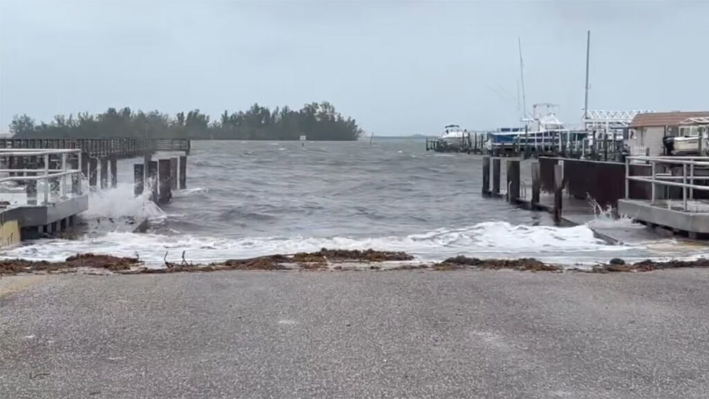
In 2022, while Hurricanes Ian and Nicole didn’t make a direct landfall in Sebastian as hurricanes, the town still endured their impact as tropical storms as they approached the region. Additionally, the area suffered from severe coastal erosion and damage to docks.
Hurricane Donna (1960)
Hurricane Donna, a Category 4 storm, holds the record for maintaining hurricane intensity for a nine-day period. Donna swept through Sebastian with sustained winds of 140 mph. The destruction left in its wake was significant, causing widespread property damage and affecting agricultural areas.
Hurricane Frances (2004)
Hurricane Frances was a long-lived storm that hit Sebastian as a Category 2 hurricane, affecting the city with severe rain, winds, and storm surges. Its slow movement compounded the situation, causing extensive flooding and damage to properties.
Hurricane Jeanne (2004)
Hurricane Jeanne struck Sebastian just weeks after Hurricane Frances, making 2004 a particularly challenging year for the city. A Category 3 hurricane, Jeanne wreaked havoc with high winds, heavy rain, and storm surge. The back-to-back hit of Frances and Jeanne in such a short span amplified the damage and delayed the recovery process significantly.
Hurricane Matthew (2016)
Although Hurricane Matthew did not make landfall in Florida, its proximity to the coastline as a Category 3 hurricane caused substantial impacts in Sebastian. High winds and heavy rainfall led to widespread power outages, downed trees, and significant property damage.
These hurricanes are powerful reminders of nature’s force and the importance of maintaining readiness for such events. For coastal cities like Sebastian, preparedness can make all the difference in protecting lives and minimizing property damage. As hurricane season approaches each year, residents are urged to heed warnings, make evacuation plans, and ensure they have supplies in case of a significant storm.