With Hurricane Ian making landfall this afternoon on the west coast in Florida, we are only hours away from feeling high winds in Sebastian. We can expect tropical storm conditions from now and through Thursday.
According to the National Weather Service, there could be sustained winds of 35 mph or greater, with higher gusts of 45 to 50 mph in Sebastian. We can expect tornado watches and warnings in Sebastian as Hurricane Ian moves into Florida.
Many people in Sebastian received an alert today of a Hurricane Warning in their area. We spoke with Indian River County Sheriff Eric Flowers, who’s at the county’s emergency command center, and he told us it’s for residents near the Sebastian Inlet in Brevard County.
The Sebastian Inlet is expected to get hurricane-force winds higher than 74 mph tonight. The warning is from Flagler County to the Inlet.
Hurricane-force winds are expected on the Atlantic coast from Flagler County to the Inlet. Portions of Brevard County are under a hurricane warning.
Officials with the City of Sebastian and Indian County are asking people to stay off the roadways and remain at home. City workers are still clearing ditches and culverts to keep the drainage system flowing, as more rain is expected.
Residents in Vero Lake Estates should be cautious about area flooding. Several roads have already flooded, with cars stalled that tried to make it through.
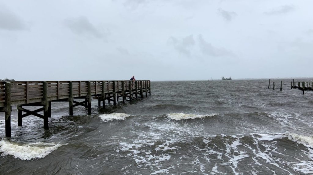
The storm surge is already making an impact on Indian River Drive, and it’s also high tide. We can expect additional flooding to occur in Sebastian as Ian moves through Florida.
Emergency shelters are open in Sebastian and Vero Beach.
Sebastian Daily will continue to keep you updated.