
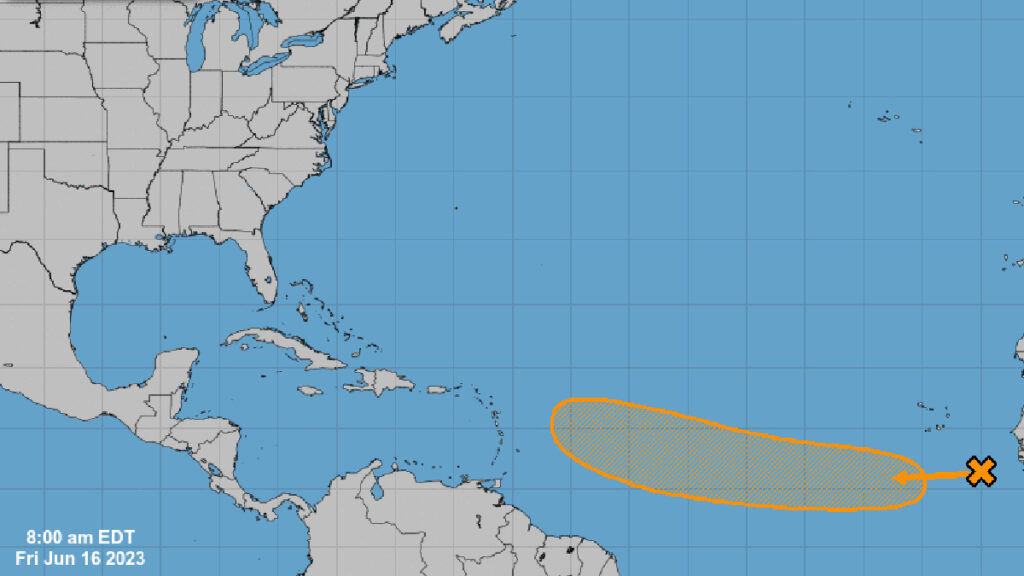
A tropical wave between Africa’s west coast and the Cabo Verde Islands has left weather experts scratching their heads. This storm system, which features scattered showers and thunderstorms, is moving west at 15 to 20 mph across eastern and central parts of the tropical Atlantic.
The National Hurricane Center has shared that the weather conditions appear suitable for this tropical disturbance to strengthen further. As a result, a tropical depression could form in the coming week.
“We’re not used to seeing something like this,” says Mike Boylan from Mike’s Weather Page. “It’s really unusual to be discussing a storm system in the Caribbean this early in June.”
The National Hurricane Center believes there’s a 50 percent chance of further development over the next week. But the big question is: where will it go once it reaches the Caribbean Sea?
Current weather models have different predictions about the storm’s path. Some suggest that the system might turn north and head back out to sea, while others show its path moving toward southern Florida.
Because these are early predictions, it’s still too soon to say where the system will end up.
If the tropical wave gets strong enough to become a storm, it will be named Bret, the next name on the 2023 Atlantic Hurricane naming list. The early appearance of this system highlights how unpredictable weather patterns can be and why we need to keep an eye on them constantly.
People who live in areas that might be affected are encouraged to stay informed about the latest weather news and start making early preparations in case the tropical wave turns into a more significant storm.

