
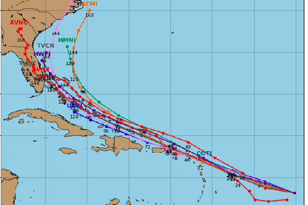
It’s still early to predict where the latest tropical wave will end up, but most of the spaghetti models of Invest 92L show the storm system turning towards Florida.
It’s important to note that the storm is not a threat to Sebastian as of right now. The storm’s path is still impossible to predict at this time.
There are environmental conditions that could keep the storm away from Florida. Also, forecasters don’t know if this storm will become a hurricane yet. Right now, they are predicting a tropical storm by Thursday.
The system is about 500 miles east of the Windward Islands moving west-northwestward at 15 to 20 mph.
“The system is producing winds near tropical-storm-force. An Air Force Reserve Hurricane Hunter aircraft is scheduled to investigate the system this afternoon and will provide more information about the current state of the disturbance,” the National Hurricane Center said in a statement.

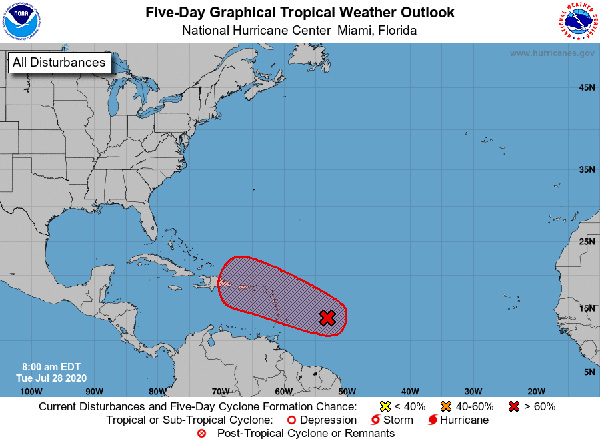
Forecasters say the storm system will be near the Virgin Islands and Puerto Rico by Wednesday night.
There’s a 90 percent chance of formation during the next five days.
Sebastian Daily will keep you updated on additional information.