We’re still almost two weeks away from the peak of the 2020 Atlantic Hurricane Season, and the tropics are heating up.
The tropical disturbances are several days away from Sebastian, Florida. One tropical wave is tracking towards Florida, but it’s still too early to predict what it will do as it moves closer.
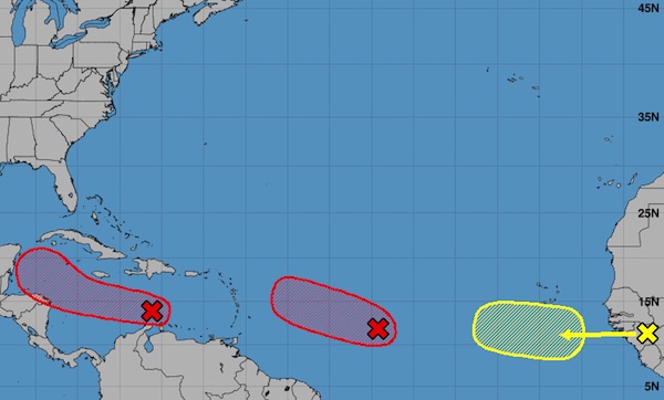
The first tropical wave is no threat to us as it moves westward at about 15 to 20 mph across the central Caribbean Sea. Forecasters say the wave will develop into a tropical depression. This system is no threat to Florida.
The second tropical wave is one we’ve been watching for the past few days, known as Invest 98L. The wave is about 1,000 miles east of the Windward Islands.
“Environmental conditions are conducive for further development, and a tropical depression is expected to form during the next day or two while the system moves generally west-northwestward at 15 to 20 mph across the central and western portions of the tropical Atlantic,” the National Hurricane Center said in a statement.

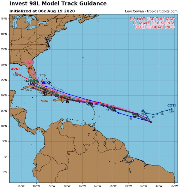
The model tracking guidance for Invest 98L has shifted to the south since yesterday. However, being this far out, the tracking is expected to change again as it moves closer to the coastline.
The third tropical wave appeared late last night, and forecasters expect this one to develop quickly.
“By early next week, however, conditions are forecast to become less favorable for tropical cyclone formation while it moves west-northwestward at 15 to 20 mph toward the central tropical Atlantic,” the National Hurricane Center said.
Sebastian Daily will keep you updated as more information becomes available.