
Hurricane season, running from June 1st to November 30th, reminds us that we live in an area susceptible to such natural events in Sebastian, Florida.
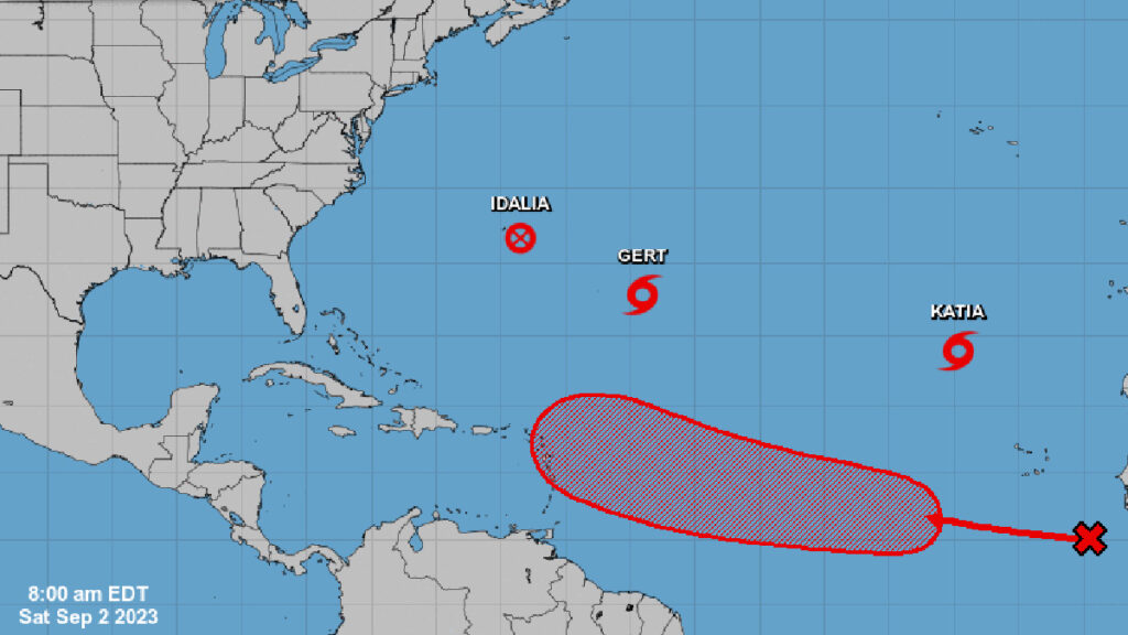
Currently, four weather disturbances are churning in the Atlantic. However, only one is moving towards the Caribbean. The latest tracking doesn’t necessarily imply an impending storm toward Florida, but it’s still too soon for definitive forecasts.
We’ve analyzed various weather models, and only the GFS model indicates the system might curve back into the ocean, veering away from Florida. The EURO model remains inconclusive as of their last update.
More precise forecasts from NOAA are expected within the next couple of days.
Meanwhile, the tropical wave is generating disorganized rainfall and thunderstorm activity, primarily located to the south-southeast of the Cabo Verde Islands.
The National Hurricane Center (NHC) has commented, “Environmental conditions appear conducive for some gradual development of this system by the middle part of next week, and a tropical depression is likely to form while it moves westward to west-northwestward at 15 to 20 mph over the eastern and central portions of the tropical Atlantic.”
The chance of this system turning into a more organized formation during the next seven days stands at 70 percent.
Sebastian Daily remains committed to keeping you updated on these developments.

