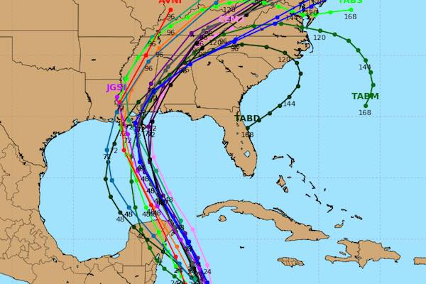
SEBASTIAN – Tropical Storm Nate is expected to strengthen as it moves past Florida as the latest spaghetti models put Hurricane Nate near Louisiana.
Spaghetti models are showing a potential landfall in Louisiana, Mississippi, or Alabama. Most computer models eventually show Hurricane Nate making landfall in Louisiana or Mississippi as the storm shifts west.
“Residents along the Gulf Coast from Louisiana through the Florida Panhandle should monitor the progress of Nate and heed any advice given by local officials,” the National Hurricane Center said.
Nate is expected to reach hurricane strength within the next 48 hours.
“Nate is forecast to be near hurricane intensity when it approaches the Yucatan Peninsula late Friday, bringing direct impacts from wind, storm surge, and heavy rainfall,” NOAA said.
There is no threat to us in Sebastian, Fellsmere, or Vero Beach at this time. We could expect more rainfall from the storm as it developed into Hurricane Nate.
Maximum sustained winds are near 40 mph with higher gusts. There won’t be much change in strength today while the center is over land.
Strengthening is likely once the center moves over the northwestern Caribbean Sea tonight and Friday.
As for Sebastian and Vero Beach, expect more showers through the weekend, but the winds won’t be as strong as they were yesterday.