Yesterday, Florida Governor Ron DeSantis issued a State of Emergency for 24 counties, including Indian River County and Brevard County, that are in the path of Tropical Storm Ian. The declaration will make available federal resources and support.
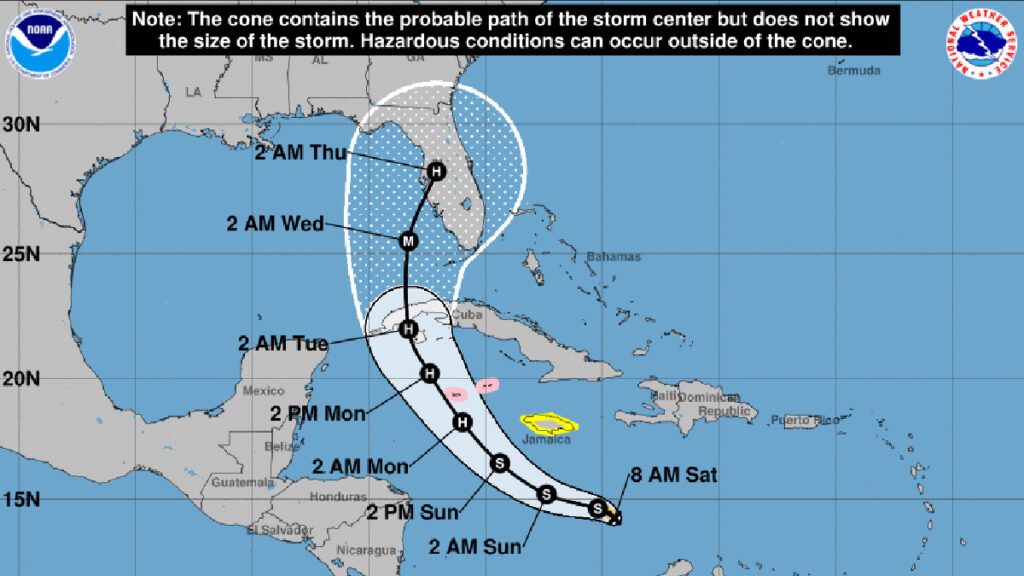
Tropical Storm Ian is expected to strengthen further to become a hurricane by late Sunday night. Ian will approach Cuba on Monday, and we should feel its impact on Sebastian by Tuesday afternoon.
The National Hurricane Center (NHC) said Ian has maximum sustained winds of 45 mph, with higher gusts. The storm is moving to the west but is expected to turn north toward Florida by Sunday.
“Given the spread in the guidance, and the still shifting dynamical models, additional adjustments to the track forecast may be needed in subsequent advisories.”
The NHC also said Ian is likely to be near major hurricane intensity when it approaches western Cuba. The storm is expected to become a major hurricane as it approaches the west coast of Florida.
Forecasters say Ian could make landfall on the west coast of Florida with maximum sustained winds of 110 to 115 mph, which will be a Category 2 or 3 storm.
In Sebastian, we could have Category 1 or 2 force winds, but it’s too early to predict as tracking for Ian is expected to change. The future outlook of this storm has changed since Friday. So, it’s good to begin your hurricane preparations no later than Monday. We could feel the impact of the storm by Wednesday.
Sebastian Daily will keep you updated on any threats to our local area.