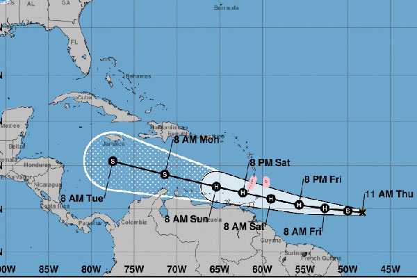
Tropical Storm Gonzalo is expected to become a hurricane by Friday morning, but the current track will send it west.
There is still an incredible amount of uncertainty in Gonzalo’s intensity forecast. Sea surface temperatures to the east of the Windward Islands are warm, and the storm is likely to be moving through an environment of relatively light shear at least for the next 48 hours or so, according to the National Hurricane Center (NHC).
Small cyclones like Gonzalo tend to succumb to adverse environmental conditions quite easily, and it’s possible that the system could struggle during the next couple of days. Most models show Gonzalo strengthening to a hurricane during the next 24 hours before it reaches the Windward Islands.
“There is a higher degree of certainty that Gonzalo would weaken once it moves over the eastern and central Caribbean Sea, where even the GFS [model] shows it opening up into a wave,” the NHC said in a statement.
Gonzalo is currently east of the southern Windward Islands with maximum sustained winds of 65 mph.