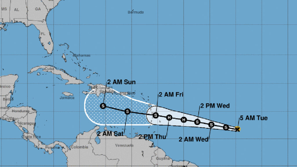
Tropical Storm Bret’s path is heading west and its track will likely remain the same for the next 1 to 4 days. Bret is likely to grow into a hurricane by Thursday, according to the National Hurricane Center (NHC).
Currently, the tropical storm is about 1,100 miles from the Southern Windward Islands. It has wind speeds of 40 mph and is traveling westward at 17 mph.
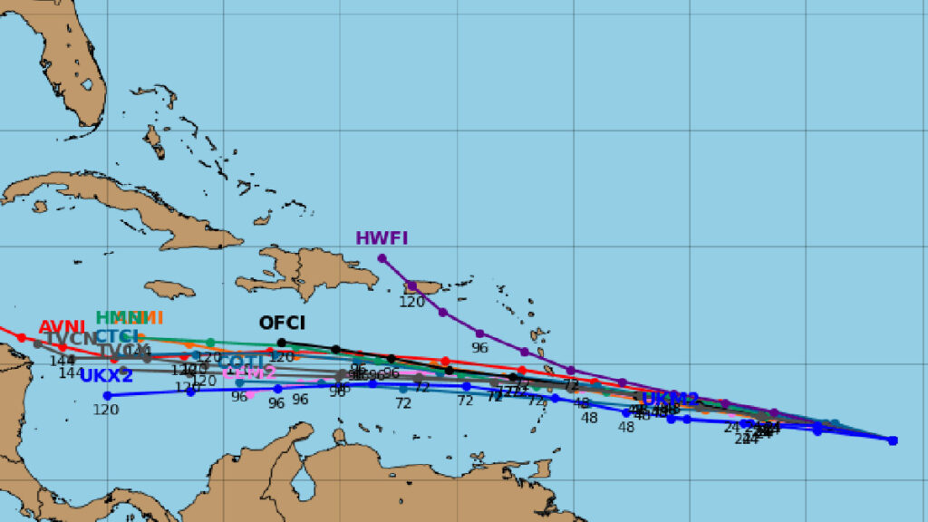
Most weather predictions agree that Bret will keep moving westward without posing an immediate danger to Florida. A strong pressure area in the middle atmosphere prevents Bret from moving north.
Meteorologists say the tropical storm could dissipate once it leaves the Caribbean Sea or shift towards the north into the Gulf of Mexico. But it’s still too soon to say for sure.
The NHC said in a statement, “There’s a wide range of predictions for where Bret will be in the next 3 to 5 days. This is mostly because of differing views on how strong Bret will become. The official path prediction is similar to the last one, but it has Bret a bit more to the south at the end of the period. The consensus models, both simple and corrected, show Bret even further to the south.”
By Friday, forecasters think Bret will downgrade from a hurricane to a tropical storm as it enters the Caribbean Sea. This prediction aligns with what the global models are suggesting.
Spaghetti models for Tropical Storm Bret’s Track
However, people in the Lesser Antilles, Puerto Rico, and the Virgin Islands should still pay close attention to updates on Tropical Storm Bret’s path and have their hurricane readiness plan prepared.
People living in Sebastian should closely monitor any shifts in Bret’s path that could bring it closer to Florida. For now, the storm’s predicted course is expected to stay south of the state.