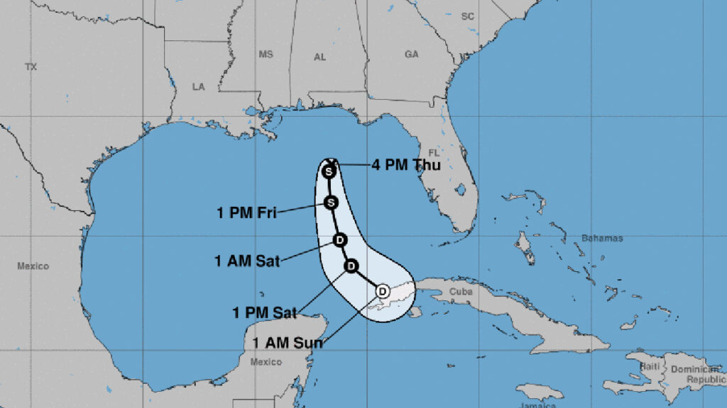
The National Hurricane Center (NHC) has reported that a tropical wave, Invest 91-L, situated in the northeastern Gulf of Mexico, has become Tropical Depression Two.
The tropical depression is projected to intensify overnight, becoming the inaugural named storm of this season. If the system undergoes an upgrade, it will be designated as Arlene. While it’s expected to take a southern course towards Cuba, moving away from Central Florida, it could still result in rainfall in Sebastian.
In the 2 p.m. update on Thursday from the NHC, the probability of the system developing further was revised upwards as it displayed enhanced organization. There’s a 70% likelihood that this system will morph into a tropical entity within the next week. The same odds apply for its transformation within the next 48 hours.
The National Hurricane Center elaborated that the current environmental conditions are somewhat conducive for additional development. If this situation persists, a brief tropical depression or storm could materialize as early as tonight.
It’s likely that the system will hover over the northeastern Gulf of Mexico throughout tonight before commencing a slow descent southward on Friday. By the weekend, however, environmental conditions are predicted to become unfavorable for additional growth as the system persists in its southern movement, likely keeping offshore over the Gulf of Mexico.
The NHC warned, “Irrespective of its development, the system could produce localized heavy rainfall across parts of the Florida Peninsula throughout this weekend.”
As we progress toward the end of the week and into the weekend, this system will potentially bring showers and thunderstorms across Florida.
On Thursday, which marks the onset of the hurricane season, the Hurricane Hunters of the NHC embarked on their first reconnaissance mission to investigate Tropical Depression Two.
NOAA, with a confidence level of 70%, forecasts the 2023 Atlantic Hurricane Season to consist of 12 to 17 named storms with winds exceeding 39 mph. Within this prediction, it’s anticipated that 5 to 9 could escalate to hurricane status with winds of at least 74 mph, including 1 to 4 potentially reaching major hurricane strength (category 3, 4, or 5) with winds surpassing 111 mph.