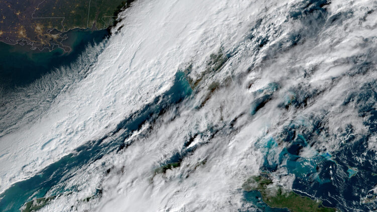
PENSACOLA — Light snow dusted parts of the Florida Panhandle on Sunday, marking a rare winter spectacle for the second year in a row as a powerful Arctic blast pushed frigid air and precipitation across the southeastern U.S.
Residents in Pensacola and surrounding areas reported flurries starting early in the morning with videos and photos of white coating lawns, cars and even palm trees. The unusual snow in Florida came amid a broader winter storm that stretched over 1,500 miles, bringing accumulating snow from the Gulf Coast to Maine.
The National Weather Service issued winter weather advisories for portions of the Panhandle, warning of slippery roads and reduced visibility. Accumulations were light, generally less than an inch, but enough to thrill Floridians.
This snow follows a record-breaking storm on Jan. 21, 2025, when Pensacola saw 7.6 inches of snow — the first significant accumulation in 130 years. Meteorologists say Sunday’s flurries are due to a strong cold front colliding with moisture from the Gulf of Mexico, creating ideal conditions for frozen precipitation in typically balmy regions.
Farther south, the Arctic air brought freezing temperatures and high winds to Central Florida. The weather service issued freeze warnings from Orlando to Vero Beach. Overnight lows dipped into the 20s and 30s, with wind chills making it feel even colder. No snow was reported in those areas.
The storm intensified in neighboring states as winter storm warnings covered parts of southern Georgia and southeastern Alabama, where several inches of heavy, wet snow were expected, potentially snarling travel and straining power lines. Along the Gulf Coast, light flurries fell in Gulfport, Mississippi, and Mobile, Alabama, adding to the wintry mix.
Forecasters said the system would move eastward, bringing heavier snow to the Carolinas and mid-Atlantic by evening. Officials urged residents to stay indoors, avoid unnecessary travel and protect pipes and plants from the cold.


