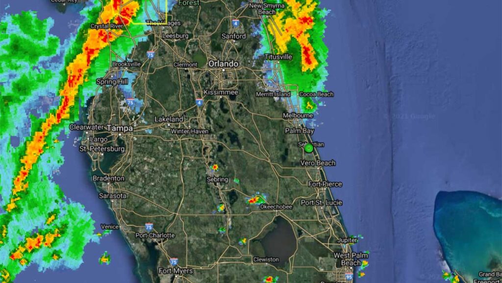
A squall line containing strong to severe thunderstorms is approaching the Sebastian area today. The threat for severe storms will be highest along and north of a line of Indian River County.
“Storm motion will be rapidly toward the east at 45 to 55 mph. Strong damaging wind gusts of 60 to 70 mph will be possible in the most intense storms. A few tornadoes will also be possible, along with passing torrential downpours and cloud-to-ground lightning,” the National Weather Service said in a statement.
We do not believe that Sebastian will get 60 to 70 mph winds, but we could get anywhere from 25 to 35 mph gusts as these storms arrive.
The most likely timing for these storms today will be from about 3:00 p.m. to 7:00 p.m.
We will keep you updated on any severe thunderstorms or tornados that might be issued by the National Weather Service.
In case of severe weather, the National Weather Service recommends moving to an interior room on the lowest floor of your home and staying away from windows.
There have been times when we don’t have severe weather when predicted in Sebastian, keeping most of the thunderstorms north of us. However, it’s better to be prepared just in case.
Further updates will be published when new information is available.