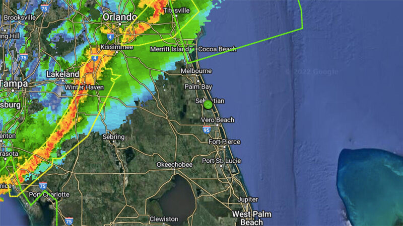
According to radar, there’s a line of fast-moving severe thunderstorms approaching Sebastian and surrounding areas from the west.
There’s also a wind advisory for our area until Sunday morning. Winds are expected to increase to 20 to 25 mph, with gusts up to 35 mph expected.
The severe storms could reach Sebastian around 1:00 p.m. It’s a good idea now to remove any loose debris in your yard, which could be used as flying objects by the high winds.
“The main threats expected with locally stronger storms will be strong to damaging wind gusts of 60 mph, hail up to quarter size, and frequent lightning strikes,” the National Weather Service said in a statement.
The storms are arriving with a cold front, so expect colder temperatures this afternoon. The low tonight will be near 44 degrees.
As we already reported in our weather forecast, Sunday’s high will only be 66 as windy conditions continue out, with potential gusts as high as 30 mph.