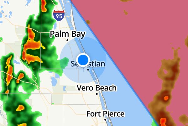
As of the 8:00 p.m. advisory from the National Hurricane Center, Sebastian, Grant, Barefoot Bay, Micco, Fellsmere, Wabasso, and Vero Beach are out of the cone of uncertainty.
However, we are still under a Hurricane Warning. Dorian is still a very dangerous hurricane, and we can expect dangerous tropical winds and storm surge.
At 5:00 p.m., we reported that Hurricane Dorian was tracking more east and away from Florida. The projected track shows Dorian remaining in open waters off the shore of Sebastian, Florida.
Dorian is expected to downgrade to a Category 3 as it passes Sebastian in the Atlantic.
“A slow westward to west-northwestward motion should resume overnight and continue into early Tuesday,” the National Hurricane Center said.
“By Tuesday afternoon, Dorian should begin its much anticipated northwestward turn,” NHC added.
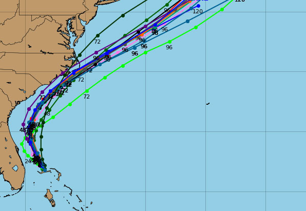
Most of the spaghetti models and hurricane models indicate Dorian will remain offshore.

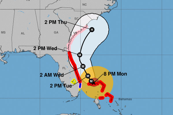
Dorian is located 105 miles away from West Palm Beach, Florida. The hurricane has maximum sustained winds of 145 mph. The present movement is stationary over the Bahamas.
Indian River County mandatory evacuations are still in place for residents east of U.S. Highway 1 and the barrier islands. Residents on barrier islands and in mobile homes in Brevard County also have mandatory evacuations.
We can still expect high winds, rain, storm surge, power loss, and potential flooding.

FPL told Sebastian Daily that they have 17,000 workers ready to restore power.
Listen to the advice given by emergency officials.
For now, all we can do is wait for that northern turn. Our next weather update will be after 11:00 p.m.
Stay tuned for more updates. We will be LIVE on our SebastianDaily.com website, Facebook, and YouTube all weekend at various times.