
Sebastian could be spared the worst part of Hurricane Dorian if the current track continues. We’ve been telling everyone since Wednesday that this storm was going to change, and to not panic. We went from a potential direct hit to what looks like a storm that might pass us as it travels closer to the west coast of Florida.
Hurricane Dorian is still building strength and is expected to make landfall in Florida Tuesday morning. Forecasters at the National Hurricane Center are not ruling out a Category 5 landfall. However, the forecast is still predicting a Category 4.
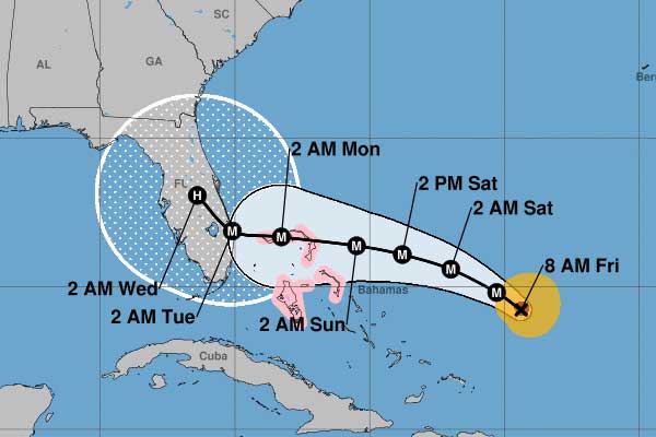
Since last night, we’ve seen a big change in the computer models that are used for tracking purposes. This morning, the new cone and path issued by the National Hurricane Center is now matching the GFS and EURO models.
The models are showing landfall near West Palm Beach or Miami and then a slow turn to the north. If the storm remains inland as it travels west before making the long northern turn, Sebastian and Vero Beach will not get the worst of Hurricane Dorian. There is a big concern for flooding.
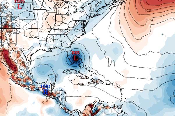
The GFS shows the storm going all the way to the west coast of Florida after the northern turn. Keep in mind that these are not official forecasts. We use these hurricane models to get an idea of where Dorian might be heading. The latest tracking by the National Hurricane Center appears to agree with these models.
Dorian is still a slow-moving storm and is located about 225 miles of the Southeastern Bahamas with maximum sustained winds of 110 mph. The hurricane is moving northwest at 12 mph.


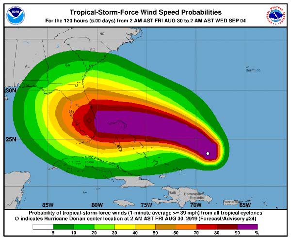
“The biggest concern will be Dorian’s slow motion when it is near Florida, placing some areas of the state at an increasing risk of a prolonged, drawn-out event of strong winds, dangerous storm surge, and heavy rainfall,” the National Hurricane Center said.
Residents in Grant, Barefoot Bay, Micco, Sebastian, Fellsmere, and Vero Beach should have their hurricane plan in place. There’s no need to panic right now. So far, the tracking is looking better for our area.
Please stay tuned for more updates. We will be LIVE later today on SebastianDaily.com, Facebook, and on our YouTube channel.