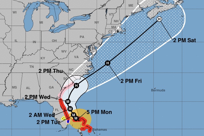
Hurricane Dorian is tracking a bit more to the east as of the 5:00 p.m. advisory from the National Hurricane Center.
Sebastian is still in the cone of uncertainty.
Sebastian, Grant, Micco, Barefoot Bay, Fellsmere, and Vero Beach are still under a hurricane warning. A storm surge warning is also in effect.
“A slow westward to west northwestward motion should resume overnight and continue into early Tuesday,” the National Hurricane Center said.
“By Tuesday afternoon, Dorian should begin its much anticipated northwestward turn,” NHC added.
Dorian is expected to be a Category 3 as it passes Sebastian in open waters on Tuesday.
Most of the spaghetti models and hurricane models indicate Dorian will remain offshore.
Dorian is located 105 miles away from West Palm Beach, Florida. The hurricane has maximum sustained winds of 145 mph. The present movement is stationary over the Bahamas.
Indian River County mandatory evacuations are still taking place for residents east of U.S. Highway 1 and the barrier islands. Residents on barrier islands and in mobile homes in Brevard County also have mandatory evacuations.
We can still expect high winds, rain, storm surge, power loss, and potential flooding.
FPL told Sebastian Daily that they have 17,000 workers ready to restore power.
Please continue to prepare for Hurricane Dorian. Please do not remove your shutters until the storm has passed. Make sure you have enough water, food, and medication to last seven days. Board up any windows and listen to the advice given by emergency officials.
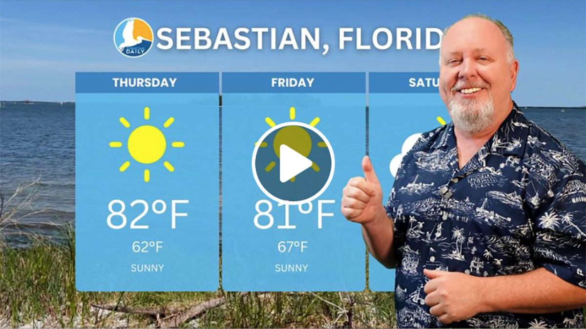
For now, all we can do is wait for that northern turn. Our next weather update will be after 11:00 p.m.
Stay tuned for more updates. We will be LIVE on our SebastianDaily.com website, Facebook, and YouTube all weekend at various times.